

Ware Mechanical overnight forecast: Monday brought another inch of rain; more possible Wednesday. High winds in Chattooga. Flood warning, watch updates.
#hometownweather
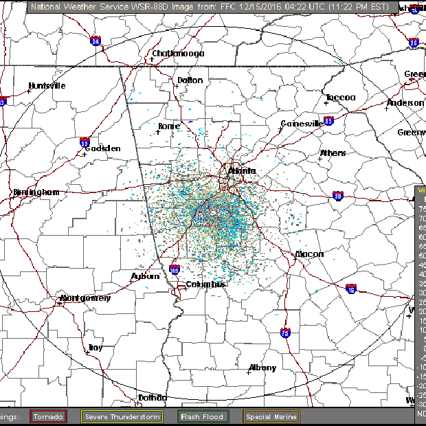
The situation:
- Rainfall since midnight: 1.05 inches.
- Highest winds: Gusts to 24 mphs.
- From E-911: Just one tree reported down, Spout Springs two miles from Blacks Bluff.
- Flood watch remains in effect through 7 a.m. Thursday.
- Chattooga, northern tier counties under wind advisory until 1 a.m. Wednesday.
- River flood warnings all remain in effect overnight.
- Just missed high temp record: In Rome, the high Sunday hit 74 degrees, breaking the old record of 71 set on Dec. 27, 1911. Cartersville also saw 73, breaking a record set in 1954. Today: Missed it by that much. The record is 73 set in 1982; the high Monday: 72 degrees. Normal for this time of year: 52. (Weather Channel)
Hazardous weather outlook:
THERE WILL BE A CHANCE OF THUNDERSTORMS TUESDAY AND WEDNESDAY
ACROSS THE AREA ALONG WITH HEAVY RAIN POTENTIAL TUESDAY NIGHT
AND WEDNESDAY FOR MAINLY NORTH AND PORTIONS OF WEST CENTRAL GEORGIA.
The forecast:
Tonight
Showers and possibly a thunderstorm, mainly before 3am, then a chance of showers and thunderstorms after 3am. Low around 54. South wind 5 to 15 mph, with gusts as high as 20 mph. Chance of precipitation is 100%. New rainfall amounts between three quarters and one inch possible.
Tuesday
A slight chance of showers and thunderstorms before 10am, then a slight chance of showers and thunderstorms after 4pm. Mostly cloudy, with a high near 62. Southwest wind around 5 mph. Chance of precipitation is 20%.
Tuesday Night
A chance of showers and thunderstorms, then showers and possibly a thunderstorm after midnight. Low around 53. Calm wind. Chance of precipitation is 90%.
Wednesday
Showers and possibly a thunderstorm. Some of the storms could produce heavy rainfall. High near 60. South wind around 5 mph becoming west in the afternoon. Chance of precipitation is 100%.
Your mobile weather report / Latest local radar / NOAA weather radio
TRAFFIC UPDATES:
Click Google Maps or Waze

Editor's picks
- Casino En Ligne Retrait Immédiat
- Meilleur Casino En Ligne
- Siti Di Scommesse
- Uk Sports Betting Sites Not On Gamstop
- Online Casino Sites UK
- Online Betting Sites Not On Gamstop
- Migliori Casino Non Aams
- Casino Online Migliori
- Gambling Sites Not On Gamstop
- Non Gamstop Casino Sites UK
- Meilleur Casino En Ligne Français
- Casino En Ligne Bonus Sans Dépôt
- Meilleur Casino En Ligne Français
- Tous Les Sites De Paris Sportifs Belgique
- Meilleur Casino En Ligne Belgique
- Siti Scommesse Non Aams Sicuri
- App Scommesse Sportive
- Meilleur Site Pour Jouer Au Poker
- Tennis Paris Sportif
- Meilleur Site De Paris Sportif International
- Sweet Bonanza Fruits Avis
- Paris Sportif Ufc
- ライブカジノ
- 銀行出金が早いオンカジ
- ライブカジノ
- 암호화폐 베팅사이트
- лучшие казино Украины
- Paris Sportif Crypto
- Casino En Ligne 2026
- Nouveau Site De Casino En Ligne
- Migliori App Casino Online
- I Migliori Casino Non Aams
- 스포츠토토
- Trang Cá độ Bóng đá
- Casino En Ligne Argent Réel France
- Nouveau Casino En Ligne 2026
- Meilleurs Casino En Ligne
- Siti Casino Non Aams
- Casino Aams Nuovi
- Casino En Ligne Le Plus Payant
Sorry, comments are closed for this post.