


@10:55 p.m. Ware Mechanical weather: Freezing rain up next; we could see a quarter inch or more overnight
From the National Weather Service: We should see another mix of freezing rain, sleet and snow to be followed by another wave, perhaps freezing rain, after 11 p.m.
The situation: Officially, we’ve seen 0.04 of an inch of snow in Rome/Floyd County tonight although we’re hearing estimates of higher amounts from various corners of the region. Through 8 p.m., Cartersville doesn’t show a trace but we know that’s not accurate.
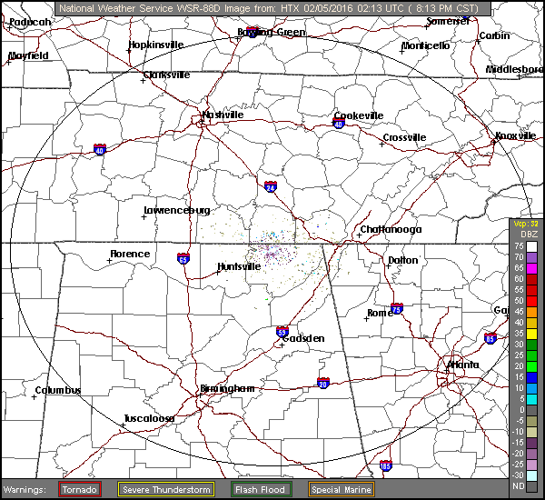
What’s next: As the radar image shows, we’re just getting started with this event. By Saturday night, we’ll have possible thunderstorms to deal with. For now, it is cold and wet.
- Freezing rain is expected now through 9 a.m. Saturday.
- Sleet now through 7 a.m. Saturday.
- Rain: Maybe an inch of rain beginning at 7 a.m. Saturday into Sunday.
Warnings and watches:
Winter storm warning: Floyd, Bartow, Gordon and Chattooga counties continue under a winter storm warning through 1 p.m. Saturday. That means more snow/ice/sleet are expected. Winter Storm Warning
Winter weather advisory: Polk County is in the “advisory” zone through 1 p.m. Saturday. Polk probably needs to be moved into the “warning” category especially after the Friday evening snowfall. Winter Weather Advisory
The forecast:
Overnight: Freezing rain and sleet likely. Cloudy, with a low around 29. Southeast wind 5 to 10 mph. Chance of precipitation is 70%. Total nighttime ice accumulation of less than a 0.1 of an inch possible. Total nighttime sleet accumulation of less than a half inch possible.
Saturday: Freezing rain and sleet likely before 8am, then a chance of rain or freezing rain between 8am and 10am, then a chance of rain after 10am. Cloudy, with a high near 49. Southeast wind around 10 mph, with gusts as high as 15 mph. Chance of precipitation is 60%. Little or no ice accumulation expected. Little or no sleet accumulation expected.
Saturday Night: Showers likely, mainly after 8pm. Cloudy, with a low around 44. South wind 5 to 10 mph becoming northwest after midnight. Chance of precipitation is 70%. New precipitation amounts between a quarter and half of an inch possible.
Sunday: Rain likely. Cloudy, with a high near 53. North wind 5 to 10 mph becoming west in the morning. Chance of precipitation is 70%.
Sunday Night: A 20 percent chance of rain. Mostly cloudy, with a low around 32. North wind around 10 mph, with gusts as high as 15 mph.

Editor's picks
- Casino En Ligne Retrait Immédiat
- Meilleur Casino En Ligne
- Siti Di Scommesse
- Uk Sports Betting Sites Not On Gamstop
- Online Casino Sites UK
- Online Betting Sites Not On Gamstop
- Migliori Casino Non Aams
- Casino Online Migliori
- Gambling Sites Not On Gamstop
- Non Gamstop Casino Sites UK
- Meilleur Casino En Ligne Français
- Casino En Ligne Bonus Sans Dépôt
- Meilleur Casino En Ligne Français
- Tous Les Sites De Paris Sportifs Belgique
- Meilleur Casino En Ligne Belgique
- Siti Scommesse Non Aams Sicuri
- App Scommesse Sportive
- Meilleur Site Pour Jouer Au Poker
- Tennis Paris Sportif
- Meilleur Site De Paris Sportif International
- Sweet Bonanza Fruits Avis
- Paris Sportif Ufc
- ライブカジノ
- 銀行出金が早いオンカジ
- ライブカジノ
- 암호화폐 베팅사이트
- лучшие казино Украины
- Paris Sportif Crypto
- Casino En Ligne 2026
- Nouveau Site De Casino En Ligne
- Migliori App Casino Online
- I Migliori Casino Non Aams
- 스포츠토토
- Trang Cá độ Bóng đá
- Casino En Ligne Argent Réel France
- Nouveau Casino En Ligne 2026
- Meilleurs Casino En Ligne
- Siti Casino Non Aams
- Casino Aams Nuovi