


3:10 p.m. Ware Mechanical alert: More concern about ‘black ice’ tonight, Saturday morning in Northwest Georgia
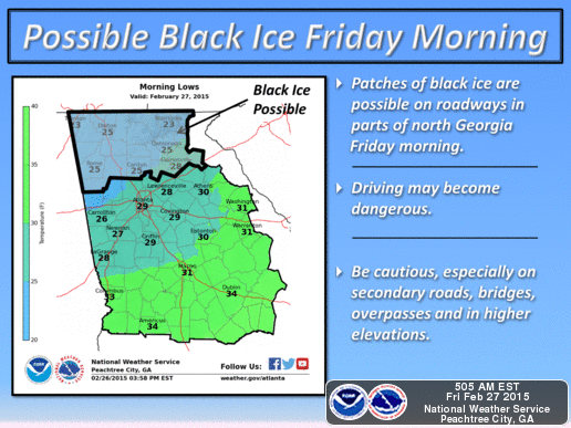
The latest: The thaw continues today with much more of Wednesday’s snow vanishing by the minute as temperatures climb to a balmy 39 degrees at 3 p.m. in Northwest Georgia. But that thaw is triggering new concerns of black ice across the region, the same way it did Friday morning as al local school systems closed because of transportation concerns. Schools are closed on Saturday but the threat is likely to occur again for weekend motorists. The “line” of concern is north of Rome up to the Tennessee-Georgia border and as far east as Cleveland (Ga.) Tonight’s low: 25 degrees.
Next up: Rain moves in Sunday and we could see as much as three inches of rain by mid next week. Temperatures will be above normal — 65 degrees — Tuesday and Wednesday.
BLACK ICE EXPECTED TONIGHT INTO SATURDAY MORNING FOR FAR NORTH GEORGIA...
BLACK ICE IS EXPECTED OVERNIGHT TONIGHT INTO SATURDAY MORNING FOR
AREAS THAT STILL HAVE PARTIALLY MELTED SNOW COVER FROM WEDNESDAY.
THE COMBINATION OF WET SURFACES FROM MELTED SNOW AND BELOW
FREEZING TEMPERATURES WILL PRODUCE AREAS OF BLACK ICE...MAINLY
NORTH OF A ROME TO CANTON TO CLEVELAND LINE.
MOTORISTS ARE URGED TO USE EXTREME CAUTION ON THE ROADWAYS.
TEMPERATURES SHOULD BE LARGELY WARMING TO ABOVE FREEZING AFTER 10
AM SATURDAY...WHEN ANY AREAS OF BLACK ICE SHOULD BE MELTING.
The forecast:
This Afternoon: Partly sunny, with a high near 39. North wind around 5 mph.
Tonight: Mostly cloudy, with a low around 25. North wind around 5 mph.
Saturday: Mostly cloudy, with a high near 49. East wind 5 to 10 mph.
Saturday Night: A 20 percent chance of rain after 1am. Mostly cloudy, with a low around 34. East wind around 5 mph.
Sunday: A 40 percent chance of rain. Cloudy, with a high near 49. Southeast wind 5 to 10 mph.
Sunday Night: Showers likely, mainly after 8pm. Cloudy, with a low around 42. Chance of precipitation is 60%.
Monday: Showers likely, with thunderstorms also possible after 8am. Cloudy, with a high near 57. Chance of precipitation is 60%.
Monday Night: Showers likely and possibly a thunderstorm. Cloudy, with a low around 47. Chance of precipitation is 60%.
Latest local radar / Latest traffic. Click Google Maps or Waze
New: Listen to NOAA Weather Radio for Floyd/Northwest Georgia. Click Radio

Editor's picks
- Migliori Casino Non Aams
- Casino Online Migliori
- Gambling Sites Not On Gamstop
- Non Gamstop Casino Sites UK
- Meilleur Casino En Ligne Français
- Casino En Ligne Bonus Sans Dépôt
- Meilleur Casino En Ligne Français
- Siti Scommesse Non Aams Sicuri
- Paris Sportif Ufc
- 암호화폐 베팅사이트
- лучшие казино Украины
- Paris Sportif Crypto
- Casino En Ligne 2026
- Nouveau Site De Casino En Ligne